ESKP
Earth System Knowledge Platform (www.eskp.de)
The geoscientific information platform „Earth System Knowledge Platform“ (ESKP) is an initiative of the Helmholtz Association and its aim is to presents research results as well as scientifically grounded background knowledge from eight centres of the Helmholtz Association. The focus lies on the topics of „consequences of the climate change", "pollutant dispersion" and "natural hazards/meteorological extreme events". Therefore, ESKP intends to collect expert knowledge and making it available and usable to the public, administration and political decision-makers.
The Institute for Energy and Climate (IEK-8) at the Research Center of Jülich (FZJ) in close cooperation with the Rhenish Institute for Environmental Research (RIU) supports ESKP by focusing on “dispersion of pollutants in case of unexpected events”. In this frame, near real-time forecasts of the transport of ash and gas emissions in the emergency case of a volcano eruption are provided. In extreme cases, reliable forecasts can be crucial for health protection and aviation safety. The ash and gas dispersion are simulated by the European Air pollution Dispersion Inverse Model (EURAD-IM), which is developed at the Rhenish Institute of Environmental Research. The model is driven by the Weather Research and Forecasting Model (WRF) and includes detailed gas phase and
particle dynamics modules, which allow for quantitative estimates of measured volcano releases. Former simulations, for example related to the Eyjafjallajökull outbreak in 2010, were in good agreement with measurement records of particle number and SO2 at several European stations.
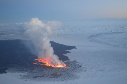
End of August 2014 a fissure eruption occured in the Holuhraun lava field on Iceland with a large continuous flow of lava and a significant release of sulphur dioxide (SO2) in the lower troposphere, while ash emissions were insignificant. For this eruption daily forecasts of SO2 dispersion were produced for the European region (15 km horizontal resolution grid) and published on our website (http://apps.fz-juelich.de/iek-8/RIU/vorhersage_node.php). These calculations were done on the Jülicher Linux Cluster Juceda and the results were published online at the RIU and FZJ.
In the middle of September 2014 several European measurement sides recorded extremely high SO2 concentrations at ground level which were predicted quite accurately in advance by the EURAD-IM (see figure). Further more, the simulations indicate that the unusual high SO2 values are due to the transport of sulphur dioxide rich air from the Bardarbunga towards continental Europe.
To simulate the transport of volcanic emissions, realistic source terms like mass release rates of ash and SO2 or plume heights are generally required. Since no representative measurements are currently available for the simulations, rough qualitative assumptions, based on reports from the Icelandic Met Office (IMO), are used. However, frequent comparisons with satellite observations show that the actual propagation of the volcanic emissions is generally well reflected by the model.
Later on, the lack of source terms will be solved by data assimilation and inverse modeling techniques. The new methods will be applied also to other extreme events like wild fires, mineral dust outbreaks and accidental releases of toxic gases and radioactive material.